
Walk by Graham Davies, History bits and Photos by Tom Digby
This circular walk takes in an ancient track-Loodle Lane-and then by field paths to Langham and back to Whissendine. It is a little longer than some other walks-about 8 miles-but has the option of breaking your journey halfway at the Ashwell Garden Centre Tea room for rest and refreshment. It is well signposted, but not all the stiles are dog-friendly; carry OS Explorer 234 map in case you get lost! The usual precautions about taking a stick and avoiding bare legs apply here: nettles are an issue on some of the paths. We describe the walk in two legs: Whissendine to Langham and Langham back to Whissendine: it starts and finishes at the White Lion pub on Main Street, Whissendine. This walk has the advantage that it can be varied from a quick evening walk to Loodle Lane and back, or to Langham for Lunch, or the full walk.
WHISSENDINE TO LANGHAM
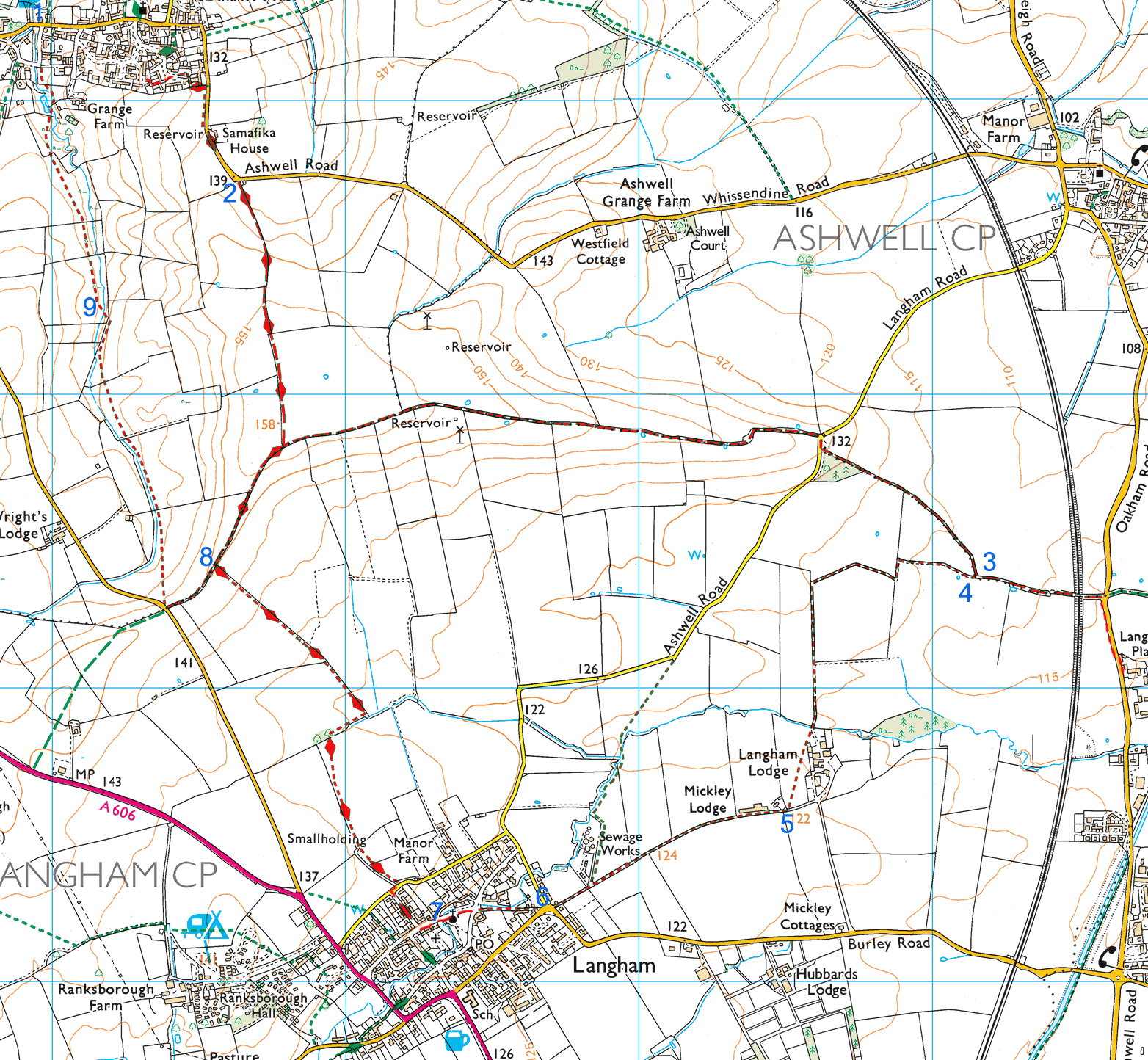
- Walk up the hill from the White Lion and take the turning marked ‘Horton’s Lane leading to Hall Close’. Ignore the immediate right turn to Horton’s Lane but continue up the hill, take the second cul-de-sac on your right and at the end, look for a footpath on the left which leads up onto Foxhill. Walk up Foxhill and look for the footpath sign on your left. This path takes you around the backs of houses and eventually emerges onto the Ashwell Road. Go through the gate and follow the road right with care, out of the village. As the road bends to the left, maintain direction along a green lane, marked as a footpath.
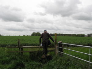
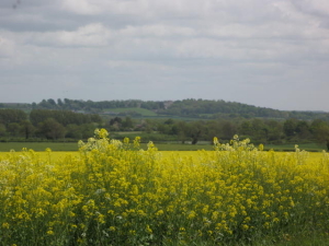
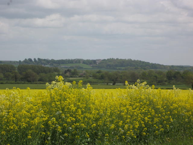
- Follow the green lane for about three-quarter’s of a mile as it climbs steadily toward the ridge ahead. At the brow it meets the bridleway which is Loodle Lane. Turn left and follow the bridleway for over a mile along the spine of the hill, admiring the views right over the Vale of Catmose toward the spires of the Langham and Oakham churches and on the left, distant views of Whissendine and Ashwell villages. When you reach the minor road joining Ashwell to Langham, cross over and turn right for just a few yards looking for the sign that invites you to re-join Loodle Lane as it continues eastward. After about a quarter of a mile, you reach an elaborate stile which marks the choice point for the next stage of your walk.
- If you feel the need for a little light refreshment and a rest for weary limbs, ignore the style and carry on along Loodle Lane until it crosses the bridge over the railway and meets the busy Oakham Road. Turn right, sticking to the cycle path and where the path ends, cross the road to the safety of a pavement on the opposite side, Maintain direction past some charming cottages before the Ashwell Garden Centre comes into view; the tea room is immediately on your left. Suitably refreshed, retrace your steps to the stile, a detour of some half a mile, but for a weary traveller, worth every step!
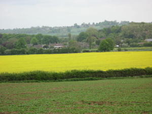
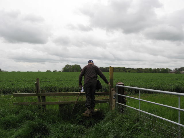
- Back at the stile, cross it and follow the path as it makes a somewhat tortious way to Langham Lodge farm, following field boundaries. Part of this path appears to have been re-routed and the OS map may not always be a reliable guide to this leg of your journey. Instead, look out for the small yellow direction signs which will eventually lead you to the yard of the farm. Here again, there has been some re-routing and a prominent sign on your right leads you through a series of paddocks separated by sometimes demanding stiles. Dog owners (and those less in need of strenuous exercise) may choose to take the alternative route also signed from the farmyard. Either way, you will emerge at Mickly Lodge, once a chicken farm, now redeveloped for light industry.
- Walk beside the front of the Lodge and look out for a small path on your left at the very end. This pleasant path leads through trees and then past a sewage farm (no problems in locating that!) and eventually to a tarred road leading into Langham.
- At the first houses of the village look right for a footpath sign which takes you on a tree-lined path around the back of the street and after a few hundred yards brings you out into Well Street. In front of you is Langham church, dedicated to St. Peter and St. Paul, and one of the largest in Rutland. Turn right along Well Street, taking in the exterior of the church as you go. At the very end is a gate leading into the churchyard and the opportunity to explore the interior of this fine church.
- At this point, you may want to visit one of Langham’s pubs for refreshment before heading back. To continue the walk, continue along Well Street before turning right into Orchard Road. At the end of Orchard Road, turn right into Manor Lane. In a few yards on the left-hand side of the road you will see a green litter bin attached to a post which marks the start of the walk back to Whissendine. The path itself is well walked and follows field boundaries for the first half mile, before emerging over a footbridge into open ground, with the ridge directly ahead filling the skyline. Follow the signs for the Rutland Round, first to the right then straight ahead to the summit of the ridge and back onto Loodle Lane.
- This time turn left on the bridlepath, taking you in the direction of Whissendine Road. Just before reaching the road, you’ll see a footpath sign on the right, pointing diagonally across a field. Follow this to the yellow marker which will direct you into the next field, where the path runs beside the field edge with a stream tinkling away behind the hedge. Another marker leads you into a third field where the track continues along the left hand field boundary. Look out for a large Ash tree growing in the hedge, This marks the point where a small path leads down a series of steps (Nettle Alert!) and a sleeper bridge, which takes you over the stream and into the open field beyond.
- Continue to follow the stream, this time with it on your right. Yellow marker posts will lead you through two further fields. Just when you have given up hope of ever seeing Whissendine again, there are distant glimpses of the Church and the windmill: you are almost there! A yellow marker beckons you into a small pasture field, with a stile in the right hand corner. The way forward is clearly marked: you re-cross the stream, traverse some more stiles, skirt a mound and pass a modern house before coming out in the Nook. The ‘White Lion’ is dead ahead: time for a quick drink? I think you have earned it!

History bit: Loodall Lane
Just after joining the green lane, there is what is thought to be a Bronze age house in the field on your left, only crop markings give the location away. Loodle lane is an Iron Age road running from Burrow on the Hill to Stamford, this section is one of the few bits left that you can still walk along, it is a ridge way with superb views over Catmose vale.
LANGHAM TO WHISSENDINE
History bit: Church of St Peter & St Paul Langham. The church of SS. Peter and Paul, erected about 1235, in the Norman, Early English and Early Decorated style, consisting of chancel, nave, south transept, aisles, south porch and a western tower with elegant spire, containing a clock and 6 bells. The chancel retains a semi-circular headed piscina (Washbasin), and on the north side an aumbry (Cupboard), the earliest parts of the present building being the chancel and tower, which are of 13th-century date, at which period probably the whole church was rebuilt. The south transept appears to have been added, or an existing transept remodelled c. 1280–90, and a further rebuilding of the whole fabric took place in the 14th century, to which period the present nave arcades, the chancel arch and the porch belong. Langham was in Leighfield Forest, so Forest Law was enforced. Basically the object was to preserve the forest area, including open land for hunting by the nobility, so harsh penalties often death were imposed for cutting down trees, poaching etc.

History bit: The Saxon Manor house. When you cross the small pasture field, look to your right, through an opening leading to another paddock. At certain times of the year you can just make out the platforms of ancient buildings, this was thought to be the site of the original Saxon Manor house.