
Walk by Graham Davies, History bits and Photos by Tom Digby
If you don’t know it, this is a delightful family walk: fit for children and dogs. In recent years, the local authority has upgraded the stiles (now with dog-friendly hatches) and the signage is much improved. It is a circular walk of between 4 and 5 miles and takes in paths which are part of the ‘Rutland Round’ (see notes at end). The maps required are OS Explorer 234 and 247. The usual precautions about taking a stick and avoiding bare legs apply here: when the nettles are in bloom, they are lethal! We have described the walk in two parts: from Whissendine to Teigh and then the return leg (residents of Teigh need, of course, to reverse the order!). We start and finish the walk at St Andrews Church on Main Street, Whissendine. Ckick on the map below to view a larger version.
WHISSENDINE TO TEIGH
The Whissendine Manors
This walk passes 3 of Whissendines 4 old Manor house site sites, which existed in 1320. The first you will see at point 1, with humps suggesting the old foundations, this was Whittlebury Manor, the field you are in was called the Park, and is thought to be a small deer park. The second manor is called Moorhall an ancient monument situated in a large field near point 10, but best viewed from the top of the hill at point 4. The last manor you will pass is our later, intact Manor house in Station road, the first building you come to as you enter the village on the left, this used to be called Hellewell Manor.
-
Go down the road just as far as the Churchyard end, then follow the footpath sign right. This takes you down a drive to a stile; bear right over this and another stile which brings you into a large field. Cross diagonally to a kissing gate which takes you out onto Station Road. Turn left and look for a footpath sign shortly on your right, across the allotments.
(The large field normally has cows grazing in it. If you have excitable dogs or nervous children (or vice versa), you may prefer to stay on the road for this first section: simply walk up Main Street past the church and turn left onto Station Road as far as the allotments).
-
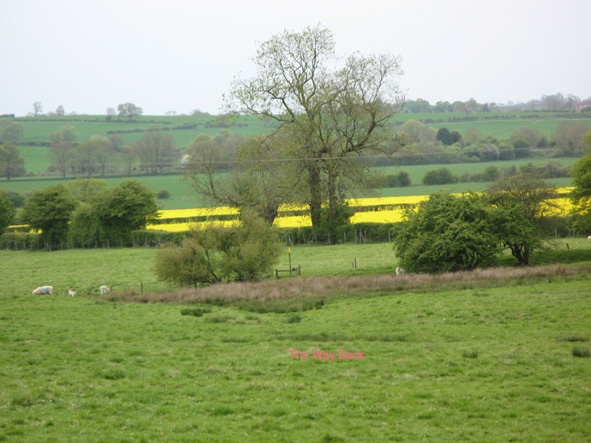
Take the path via gates through the allotments. This path leads to a small pasture with a gate to the left: go through the gate and cross over a farm track and follow the footpath sign onto the Stapleford Estate lands. The marker points you straight down the field toward the far hedge: the path will be clear in any crop. When you reach the hedge descend some steps to a wooden bridge and cross a small stream.
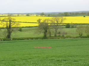
- When you have crossed the bridge, climb up into the next field and you will see another marker beckoning you up the slope to the far skyline. This is the nearest thing you get to a hill in North Rutland. Pause at the top for a pretty view back toward St Andrews and on toward Waltham. Cross over a railway sleeper bridge –nettle alert- and come out into a third, very large field.
- Your way here is first along the right-hand hedge for about 100 yards and then diagonally across the field to a stile in the far right hand hedge: again, the path should be clear in crops and there is a yellow marker at the style in the hedge. Cross over the stile into the next field; the path veers left in the general direction of Gate House and brings you out onto Teigh Lane.
- Follow the lane right through the green metal gate into Gate House yard-be sure to fasten the gate after you-there are geese and hens running free. Go through the yard and out of the gate ahead: the railway line from Oakham to Peterborough stretches before you. Cross carefully here: there is good visibility in both directions. Go through the gate on the other side and follow the green lane ahead, ignoring the footpath sign on your left .
-
The green lane takes you just over a mile to the Ashwell-Wymondham road, crossing a substantial bridge over a stream on the way-look out for herons fishing the stream. When you reach the main road, turn left along the verge for about 50 yards and then take the first left down an (unmarked) tarred road leading into Teigh. Pause at the Old Rectory which was used as the house of the odious Mr Collins in the BBC’s 1995 adaptation of ‘Pride and Prejudice’. Continue as far as the parish church which demands a visit.
Holy Trinity Church
Holy Trinity, Teigh was rebuilt in 1782 in the Strawberry Hill gothic style of the period. The church interior is very unusual with the pulpit above the door and the seating for worshipers looking inward to the main isle. A brass tablet commemorates the 11 local men and women who fought in World War One and their safe return; Teigh is one the few ‘Thankful villages’ in the diocese. Another plaque lists all the rectors from 1238. They include the Reverend Henry Tibbs, arrested and briefly interned in 1940 for alleged fascist sympathies and accused of harbouring German spies. He appealed successfully and returned to his parish, but died shortly afterward in 1943. The record of his appeal was recently released by the Public Records Office (file HO 45/23738

TEIGH TO WHISSENDINE
- The footpath back to Whissendine begins across the road from the Church door. The footpath sign directs you across a couple of sometimes marshy fields. Walk toward the right-hand hedge; as you traverse the second field, keep a look out for a gate sitting on its own, the surrounding hedge having long disappeared. Go around this and through an adjacent gate in the hedge immediately to your right, over a sleeper bridge into the next field.
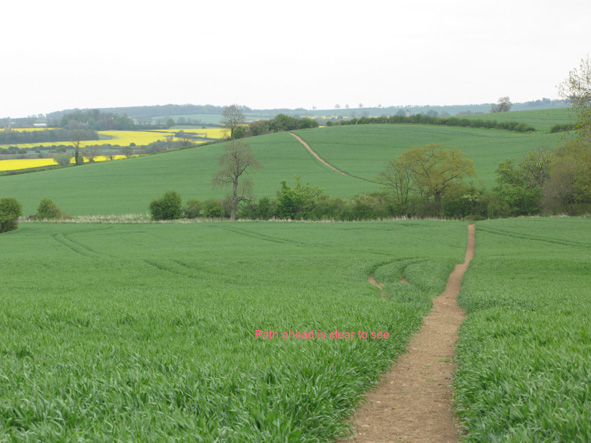
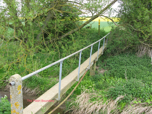
- Here is the only stretch which presents any kind of navigational challenge. You need to walk left along the gap between the hedge and any crops. Keep direction to the end corner of the next field. Just when you think this must be a dead-end, you’ll see a familiar yellow marker pointing to a single plank bridge.
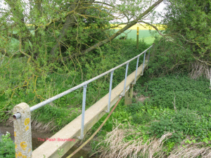
- Cross this rather wobbly bridge and go up into another large field where the path diagonally across the field to a gate in the far left-hand corner: the path should be clear through any standing crop. This brings you back to the start of the green lane. Carefully re-cross the railway, say hello again to the geese and hens at Gate House, close the gate and walk straight ahead along Teigh Lane.
-
Break your walk to take in the Pillbox on the right, one of many thrown up in 1940 under fears of invasion. Keep on Teigh Lane until you reach Station Road and turn left back to Main Street, Whissendine and St Andrews’ Church.
The Pill Box
The Pill Box according to Mike Osbourn’s invaluable “20th Century Defences of Britain” is a type 22, similar to others at Brooke and Exton, and was to defend a Searchlight Battery in the adjacent field. The entrance is to the rear, protected by pistol slits on either side of the door, and nettles!
Notes
The Rutland Round The Rutland Round is a 65 mile-long footpath walk devised by John Williams, a retired teacher, which follows roughly the boundary of the county, taking in many attractive views and interesting sites of Rutland. John’s illustrated guide to the walk-The Rutland Round (2000) – is still available (try Walkers in Oakham). It is possible to break the walk up into a series of shorter rambles, making use of rural bus services for the start and finish points.